Last reviewed: August 2, 2026. Three weeks in South America is enough for a memorable multi-country trip, but not for a continent-wide highlight reel. The most successful routes follow one geographic idea: the central Andes, southern cities and Patagonia, or Colombia and Ecuador. Each itinerary below limits major flight days and protects the connection home.
Choose the route whose pace, altitude and budget fit you. Combining the cheapest flight from every country usually produces the most expensive trip in lost days.
Which three-week South America route should you choose?
Choose Route 1, the Andes, for archaeology, high-altitude landscapes and Uyuni. It requires deliberate acclimatization.
Choose Route 2, Patagonia, for hiking, glaciers and two major cities. It costs more and needs weather flexibility.
Choose Route 3, Colombia and Ecuador, for colonial cities, Caribbean coast and the Galapagos. It has the widest budget range because the islands are a major add-on.
Route 1: Peru, Bolivia and northern Chile
Days 1-3: Lima
Arrive, recover and give Peru’s capital two full days. Use one for the historic center and a museum, and one for coastal neighborhoods and food. Lima is also the buffer before flying into the Andes.
Days 4-9: Sacred Valley, Machu Picchu and Cusco
Fly to Cusco and continue to the lower Sacred Valley. Spend two nights there, one night around the Machu Picchu journey and two nights in Cusco. Our detailed 10-day Peru itinerary explains the ticket sequence and altitude logic; compress it only by removing Lima or a Cusco day, not by removing acclimatization.
Days 10-12: La Paz
Fly when the budget allows; the overland route is long and should include Lake Titicaca as a real stop rather than a night bus used to save a hotel. La Paz sits at high elevation, so keep the first day measured even after Cusco.
Days 13-15: Uyuni circuit
Fly or use an overnight connection to Uyuni, then take a vetted three-day tour toward the high-altitude lagoons. Use our Salar de Uyuni operator checklist before booking. Continue toward Chile only when your immigration and border plan is confirmed.
Days 16-18: San Pedro de Atacama
After the border transfer, sleep and choose two excursions rather than booking sunrise, sunset and stargazing every day. Altitude remains relevant, and some observatory activities depend on moon phase and cloud.
Days 19-21: Santiago and departure
Fly from Calama to Santiago. Spend a full city day and keep the final night before the long-haul flight. If the international schedule is separate, make the margin larger.
Route 2: Buenos Aires, Los Glaciares and Chilean Patagonia
Days 1-4: Buenos Aires
Use three full days for historic neighborhoods, food, museums and one evening performance chosen for its quality rather than a package checklist. Stay near transport and avoid changing hotels.
Days 5-9: El Calafate and El Chalten
Fly south. Give Perito Moreno Glacier one day, El Chalten two hiking days and the transfers their own space. The harder hike should go on the better forecast, not automatically on the first morning.
Day 10: Travel reset
Return to El Calafate, do laundry and prepare for the border. This day keeps a delayed hike from breaking the international bus.
Days 11-16: Puerto Natales and Torres del Paine
Cross into Chile, then use Puerto Natales as a base for a park overview, one major hike and a weather buffer. Travelers undertaking the W trek should replace these days with a properly reserved trek plan. Our 12-day Patagonia itinerary gives the daily detail.
Days 17-21: Santiago or Valparaiso
Fly from Puerto Natales or Punta Arenas according to the seasonal schedule. Use Santiago as the final anchor. Add Valparaiso only as a considered day trip or overnight, not a late detour before departure.
Route 3: Colombia, Ecuador and the Galapagos
Days 1-4: Bogota
Arrive, acclimatize to the city’s elevation and explore a defined section of the historic center with museum time. Keep one flexible day for weather, food or a nearby excursion.
Days 5-8: Cartagena
Fly to the Caribbean coast. Three full days cover the walled city, Getsemani, Castillo San Felipe and an optional boat trip. The Cartagena itinerary explains how to choose that sea day without losing the city.
Days 9-12: Quito and mainland Ecuador
Fly to Quito, usually with a connection. Give the old city a day, then choose one mainland excursion or an additional city day. Do not place the Galapagos flight immediately after a fragile international connection.
Days 13-19: Galapagos
Use a seven-day land route, cruise or hybrid. The islands involve a Transit Control Card, park fee and controlled visitor sites; read our Galapagos entry and itinerary guide before selecting the airport.
Days 20-21: Mainland buffer and departure
Return to Quito or Guayaquil and sleep on the mainland before a separate international ticket. Use the final hours for one focused activity, not another domestic flight.
Use open-jaw flights to protect time
Search for a multi-city ticket that arrives at the first route anchor and leaves from the last. Then price the regional flights separately and together. One booking can provide better protection during disruption, while separate tickets may be cheaper but shift the connection risk to you.
Do not judge a route by flight duration alone. Airport transfers, early check-in, baggage collection and schedule frequency can turn a 90-minute flight into a full travel day.
Border and visa planning
Entry rules depend on nationality, residence, passport type and trip purpose. Check every country’s official immigration or consular source. A visa exemption for one country says nothing about the next, and a regional tour operator cannot waive an immigration requirement.
Keep onward tickets, accommodation addresses, insurance and proof of funds accessible. When crossing by land, confirm the actual border post, operating hours and how the bus handles formalities.
Plan altitude as a route, not a footnote
The Andes route should climb progressively where possible. Do not fly from sea level, schedule an extreme-altitude day trip and then board an overnight bus. Serious symptoms require descent and medical attention, not determination.
Patagonia has less altitude exposure but more wind, cold and remote trails. The northern route combines Bogota and Quito elevation with lower coastal days.
A useful budget framework
Price each route in five columns: long-haul flights, regional transport, accommodation, fixed attractions or tours, and daily spending. Patagonia’s transport and park logistics can be costly. Galapagos fees and boats make Route 3 highly variable. The Andes route can be less expensive, but a safe Uyuni operator and Machu Picchu logistics are not sensible places to chase the lowest price.
Five ways travelers lose a week
- Adding a fourth country to collect another border stamp.
- Booking international and domestic tickets with no recovery night.
- Using overnight buses after strenuous altitude or hiking days.
- Moving hotels inside the same city for a slightly cheaper rate.
- Assuming every attraction operates daily in every season.
Frequently asked questions
How many countries can I visit in three weeks?
Two or three connected countries is realistic. More is possible on paper but usually replaces destinations with airports and border days.
What is the best first South America itinerary?
The Peru-Bolivia-Chile route suits archaeology and landscapes; Patagonia suits hiking; Colombia-Ecuador suits city, coast and wildlife variety.
Can I travel South America without speaking Spanish?
Yes on these routes, but basic Spanish materially improves transport, food and problem-solving. Guyana, Belize and parts of the Caribbean use English, but they are separate route choices.
Should I book every day in advance?
Book fixed tickets, scarce accommodation and major transport. Leave flexible days for weather and recovery, particularly in Patagonia and the Galapagos.
Build the route country by country
Use our English guides for Peru, Bolivia, Chile, Argentina, Colombia and Ecuador to check the current entry and transport details behind your chosen itinerary.
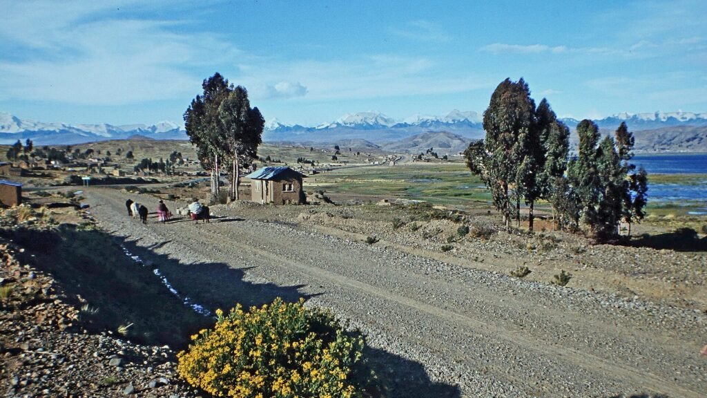
Featured image: Bolivian Altiplano by W. Bulach via Wikimedia Commons, CC BY-SA 4.0.